(shared with Missouri)
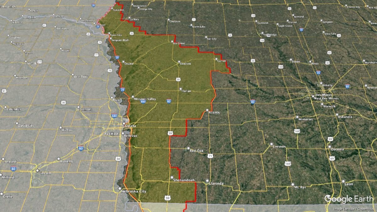
This AVA is located in western Iowa and northwestern Missouri. The district is a long, narrow north–south orientated swath of land along the Big Sioux and Missouri Rivers, covering 12,897 square miles (8,254,080 acres) from Hawarden, Iowa, to Craig, Missouri. It is located in a region characterized by extremely deep layers of wind-deposited soil called “loess.” The loose, crumbly soil composed of quartz, feldspar, mica, and other materials as grounded into a fine powder by glaciers during the Ice Ages. These soils reach as deep as 300 feet (91 m) in places. When the glaciers melted, the water pushed this “glacial flour” down the Missouri River Valley. As the waters receded, the exposed silt dried, was dispersed by the prevailing westerly winds and deposited across the landscape over broad areas that have formed the hills over time.[3] The main benefit of the deep, friable soils is they offer little impediment to root systems where vines can grow deep into the ground in search of nutrients. The soils also drain easily, which is advantageous given the area’s high levels of rainfall. Erosion can be an issue in Loess Hills, although, over the years, hillsides were carved out making suitable pockets for wine-growing. These hillside vineyard sites prevent cool air from pooling above the vines, reducing the risk of frost. Summers are hot and humid with a majority of the annual precipitation concentrated in the warmer months. In contrast, it is not unusual to see vineyards blanketed in snow throughout the winter period.
See winery listings for this region